|
|
Post by jon hynes on Sept 1, 2009 2:14:49 GMT -5
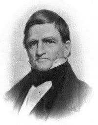 Moses Bagg Moses Bagg |
|
|
|
Post by dgriffin on Sept 1, 2009 7:10:42 GMT -5
WOW!! Thanks for all those photos!
No, not the Averell House, the place on the left of the sketch the train is headed for, where the tracks lead the train under a covered station platform. Notice that its portico is just like what can be seen on the Baggs Hotel in the photos you put up. But that would put Baggs hotel in a spot that throws off my orientation when comparing to what's there today (or isn't there.)
|
|
|
|
Post by jon hynes on Sept 1, 2009 9:52:55 GMT -5
WOW!! Thanks for all those photos! No, not the Averell House,  |
|
|
|
Post by jon hynes on Sept 1, 2009 10:08:38 GMT -5
 I wondering if this Averell House later became the Center Hotel. |
|
|
|
Post by Clipper on Sept 1, 2009 10:53:24 GMT -5
If I am not mistaken, the big building in the center of Reply #22 is UFA. Ralph could probably tell us, as his house would also be in that picture.
It looks like a view of UFA from the East.
|
|
|
|
Post by fiona on Sept 1, 2009 15:45:55 GMT -5
OK. Utica in the snow photo, no 2. If you orient yourself to the Kanatenah, at the far upper left hand corner of the photo, and then the Olbiston, across the road, continue on down Genesee Street to Hobart, head east up Hobart, the large building in the center is UFA. More later.
|
|
|
|
Post by dgriffin on Sept 1, 2009 17:15:43 GMT -5
Oh, yeah!! UFA ! I would have never guessed that. But, yes, there's the "penthouse" on top of the Olbiston. And sure enough, there's my grandfather's house on Steuben St. in the lower right hand corner. And that building I mentioned toward the bottom is probably not a school, but an apartment house. That's vaguely familiar.
And Hobart tees at Steuben, as can be seen in the photo, because Johnson Park's outlet was Square St.
|
|
|
|
Post by dgriffin on Sept 1, 2009 20:01:42 GMT -5
 Bagg's Hotel Bagg's Hotel Looking East So, would you say the street running to the east is Main? or Broad or Catherine? |
|
|
|
Post by fiona on Sept 2, 2009 13:27:37 GMT -5
NO. I don't think it's a sketch. I believe that it's a steel engraving and I think that the words next to Averall House say JB Wells Company. Mr. Wells had a beautiful Italianate home on Genesee Street near the corner of Tracy, SW corner. The house later became a senior center and it now the Ship Rite Building.
|
|
|
|
Post by dgriffin on Sept 2, 2009 23:33:17 GMT -5
When Jon said sketch, I was thinking (any kind of) artist's rendering versus a photo, although I don't know how they would get a camera that high in 1848.  Though I'll bet you're right about a steel engraving, Fiona. |
|
|
|
Post by jon hynes on Sept 3, 2009 1:37:22 GMT -5
Bagg's Hotel Looking East So, would you say the street running to the east is Main? or Broad or Catherine? I have an article not quite ready to publish here but am still confused as to the exact location. Perhaps I'll have time tomorrow. I think the article is saying it was on the corner of John and Main. |
|
|
|
Post by dgriffin on Sept 19, 2009 22:06:37 GMT -5
Utica Herald Dispatch
December 19, 1913
Click twice to maximize.

|
|
|
|
Post by dgriffin on Sept 19, 2009 22:22:29 GMT -5
This is the oldest view of the Busy Corner I've seen. Don't know the date. It was on NYPL. The description with it says, "Genesee Street, from Bleecker, looking down. (1866? 1900?)" I'd say certainly closer to 1870. So, that must be what I remember as Daws on the corner, and what would become the Boston Store beyond it. If I'm interpreting the phrase correctly. I suppose we could be looking down Bleecker and that's an earlier St. John's tower in the background. The church WAS rebuilt, though I don't remember when.![]() www.windsweptpress.com/images/busycorner www.windsweptpress.com/images/busycorner old.jpg[/img]
|
|
|
|
Post by dgriffin on Sept 19, 2009 22:45:39 GMT -5
Actually, looking at the 1883 map (below), the angle of the corner is wrong for Daws. It must be the southeast corner in the photo, and that's St. John's in the background. I'm surprised St. John's had a clock on the earlier steeple. I don't think I ever saw a clock on a Catholic church steeple. On the map, Bleecker runs along the bottom. That's Jay street interrupted by the canal, and Catherine above it.  Also notice on the map the arcade. So when I would cut through the Boston Store from Genesee to Bleecker in the 1950's, I was honoring an old tradition. Also notice the Post Office, which never moved. |
|
|
|
Post by dgriffin on Sept 19, 2009 23:40:03 GMT -5
Putting together plates B and F from the 1883 Utica City Atlas of maps, we have the following:  Here's the engraving of Baggs Square, again:  So, as seen in this view, the far end of Baggs Square has Main St entering on the left (east) and Whitesboro St. entering on the right. John and Genesee form a V, with John runing up the left leg and Genesee the right leg. Baggs Hotel runs down the left side of the square, coming toward us to Water Street. The map shows the tracks running over what was Water Street. The old course of the Mohawk is just over the tracks, below the frame of the engraving. I remember what we used to call Baggs Square, where Main St. met John and Genesee. But that was just the southern edge of it. By the time I came along, almost all of Baggs Square was gone ... under the bridge that rose over the RR tracks. Today, another whole block is gone, under the new bridge. |
|


